28 June 2013
Carmignano tb, the App developed by Tuscany's Showcase
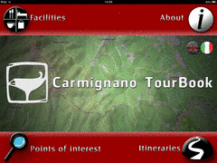
The home page of the App
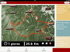
Overview of the Carmignano's area
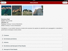
Details section
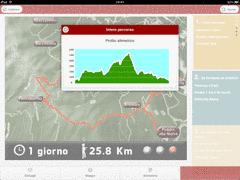
Altimetry of the selected stage
The goal of the CreativeCH Tuscan showcase is to promote the rich heritage of lesser known, “off the beaten path” cultural itineraries, often overshadowed by the major destinations.
To achieve this, the team at Vast-Lab has developed an application for smartphones and tablets with the intention of reaching a wide audience of nature lovers and history buffs by making use of the currently available innovative modern technologies.
During the initial phases of development, intense collaboration between Vast-Lab, local authorities and the Soprintendenza per i Beni culturali ed Archeologici della Toscana lead to the idea of creating an app series that would in future cover other areas of Tuscany, besides the two already included in the initial project. TourBook will therefore consist of a series of downloadable guides, which can be collected and enjoyed throughout the year, regardless of Internet connection, as the functions are available offline.
The first area affected by our showcase is located in northern Tuscany, in the area of Carmignano, which lies about 30 kilometers from Firenze. The tour encompasses various types of interesting points, spanning from Etruscan necropolis to medieval churches and an abbey, to panoramic views of the plains below and breathtaking natural landscapes, to Museums and local products.
Carmignano tb is currently available only for iOS from the App Store.
The Android version will arrive in September 2013. The interface is very user-friendly and intuitive, as the depth of navigation is minimal. The app is currently available in Italian and English, and the language can be selected from the app’s homepage. Other European languages will be implemented in the near future.
From the homepage, users can access the Itineraries section of the app showing an overview of the area and all the stages of the tour. The entire 25 km route takes about 10 hours on foot to complete, but it can be broken down into smaller sections. The level of difficulty of each section is indicated by the colored dot next to the indications of length and time: green is easy, red is difficult, yellow in between.
The lateral bar gives the details of the various stretches of the overall itinerary.
Below the map are three sections: the Details section provides images and information on each point of interest found along the route; Altimetry shows the elevation of the paths travelled; lastly, the section Map will open an interactive page from where you can locate each point of interest and view related material, locate your position along the itinerary through your device’s GPS system, visualize the available services surrounding your location. The user can choose, which kind of service to highlight through the Services section on the interactive map: restaurants, hotels, apartments and farmhouses. The blue check mark found on the symbol indicates that offers are available through the Amici del Museo association. More information is provided by selecting the corresponding tab below the interactive map.
A complete listing of both the Points of Interest and the Services offered are accessible directly from the homepage. A search for a specific item will show all the itineraries, which it is a part of.
Besides making the application available in additional languages, future improvements will include new panoramic images of tombs or other locations that cannot be visited due to the fragility of the site, social networking tools to improve visibility and appreciation of the TourBook series, and a specific page on Vast-Lab’s website to encourage users to share their photos, experiences and suggestions.
back


